A new way to see your herd
And improve your bottom line
From morning coffee dashboard checks to processing day at the chute. Terra Optics provides the digital infrastructure for modern land stewardship and precision ranching.

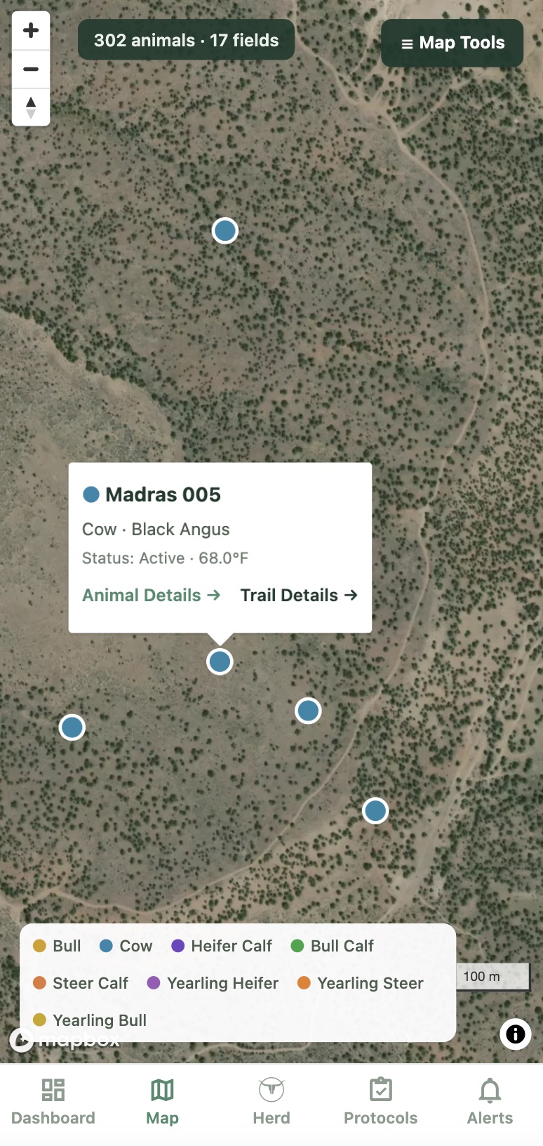
Every tagged animal on a satellite map
Keep track of your most valuable animals and their tendencies across all your pastures and allotments without the need for cell service. Color coded pins allow for quick visual identification while animal detail screens and heat maps provide additional layers of herd activity data.
- check_circle Direct-to-satellite GPS locations
- check_circle Geofence field mapping and animal assignments
- check_circle Quickly go between a map and animal details
Enhanced animal tracking and stray recovery
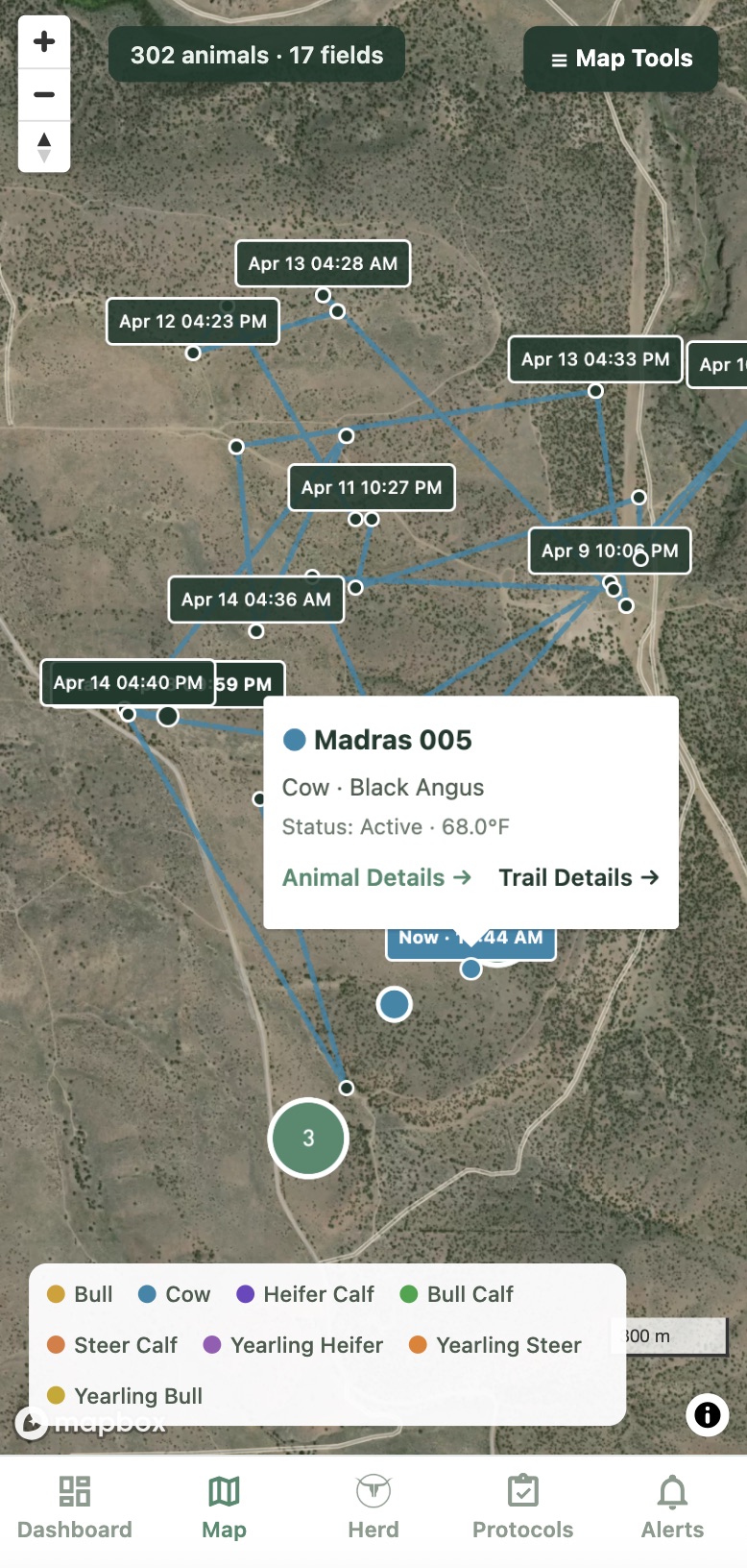
Locate and recover strays with precision and efficiency. Draw your pasture lines, and get pinged when an animal wanders out. Tap their card to pull up a GPS trail or arm the tag to alert its next check in. Export the location to Google Maps to navigate directly to the last position.
- check_circle Alerts when an animal leaves an assigned geofence
- check_circle Animal trails and geofence heat maps
- check_circle Export coordinates to Google Maps for offline navigation support
Animal performance, graded every day
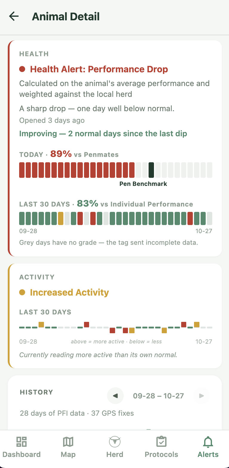
Enhanced vision into animal performance and health. Every tagged animal is graded daily on their performance against their own normal and against the animals in the same pen. Any abnormal drops in performance show up as an alert and a case on the animal's page. If they return to baseline, the case goes away.
- check_circle Daily performance data on grazing, walking, rumination and resting
- check_circle Graded daily performance against the animal's rolling history
- check_circle Daily comparison against the animal's penmates
Reproduction insights and tracking
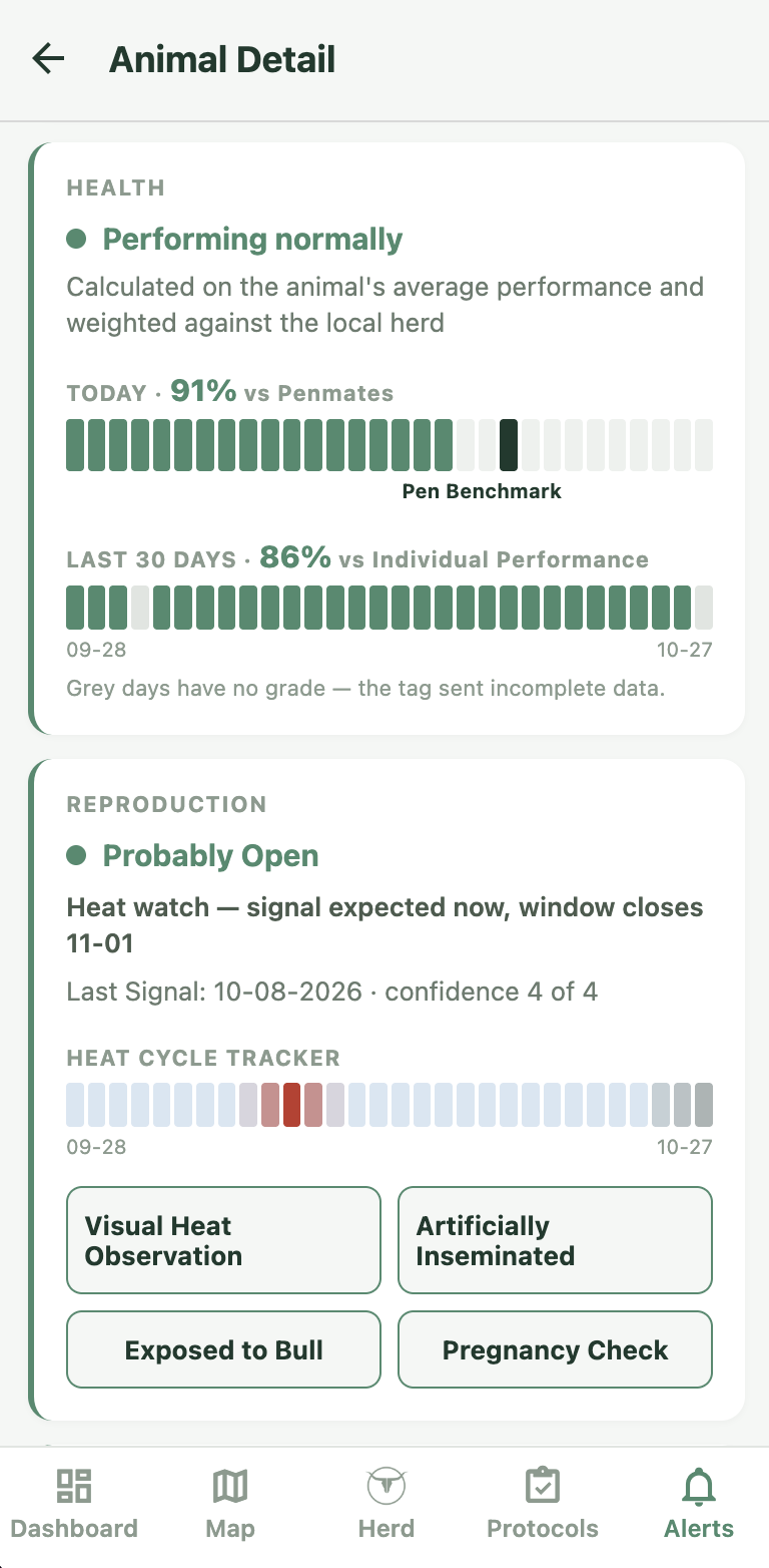
Gain extra insights into your breeding operations. Track heat signals generated by a Gen6 tag or observed with your operation's visual tools to enhance breeding efficiency. Log pregnancy checks and AI protocols to estimate when calves should arrive with added precision. Get notified when calving events start with GPS locations.
- check_circle Heat cycle alerts, tracker and timeline outlooks
- check_circle Interactive AI and pregnancy check workflows
- check_circle Calving alerts with GPS locations
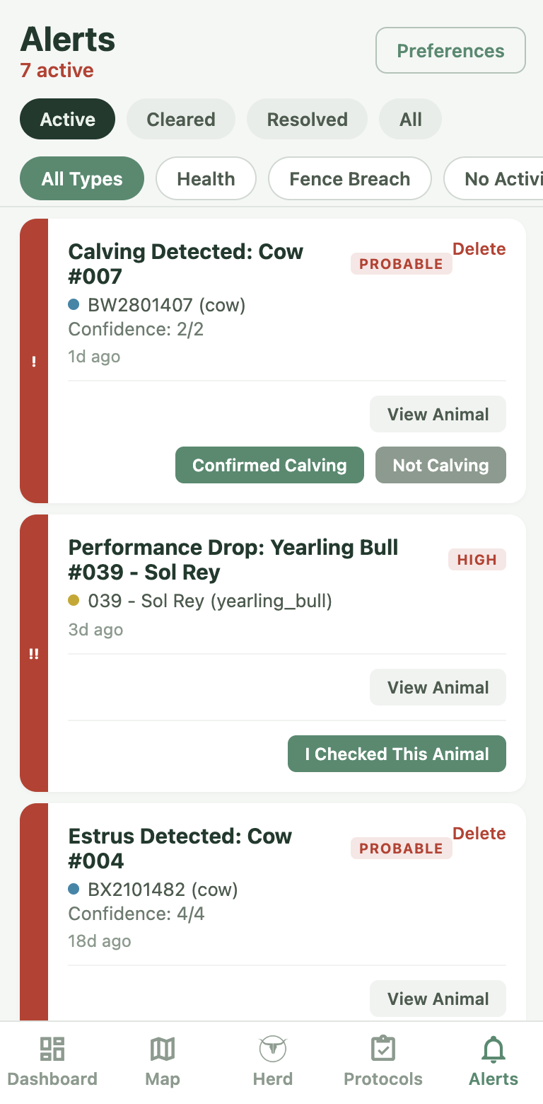
Interactive and customizable alert system
Know what's happening before you ride the field. The interactive and dynamic alert feed shows you calving events, heat cycles, a performance drop, an animal out of its pasture, or lets you know when a specific animal you're watching has checked in via satellite. Each card carries an interactive workflow that helps you track precision herd data with ease.
- check_circle Dynamic and sortable alert feed
- check_circle Customizable alerts with self updating abilities
- check_circle Interactive workflows for precision data gathering
Detailed animal records
Easily and quickly add or modify animals to keep track of important information. Set up new animals by batch or individually. Update records with customizable protocols from the office or at the chute. Auto populate details through interactive daily workflows and tag data feeds.
- check_circle Batch protocols and edits from the office or chute
- check_circle Import and export herd data
- check_circle Record data automatically through tag interactions

More built-in tools
Every detail of your operation, managed with digital accuracy.
Tag health at a glance
Every animal's page shows when the tag last reported, how accurate the fix was, the battery level and the device temperature. You know whether you are looking at fresh data before you act on it.
Lost and shed tags
A tag that stops reporting is marked rather than quietly dropped, and a tag that comes off still shows its last position so you can go and pick it up. A quiet tag is never mistaken for a missing animal.
Share a location
Send an animal’s position to whoever is closest to it. They do not need the app, an account or a login — they get the spot on a map.
Backfill your tag history
Already running Ceres tags on another platform? Once your animals are set up we can pull your existing tag history onto them, so you start with a record rather than a blank page.
Works where the service does not
Rural internet is spotty. The app holds what it has, keeps working, and syncs when the signal comes back.
Ready to optimize your operation?
Join ranchers across the world that are utilizing Terra Optics and Ceres Tags to enhance their operations.