Know where every animal is.
From anywhere.
The ranch management app with satellite GPS tracking. See your herd on a map, get alerts when something's wrong, run protocols at the chute — all from your phone.
The ranch management app with satellite GPS tracking. See your herd on a map, get alerts when something's wrong, run protocols at the chute — all from your phone.
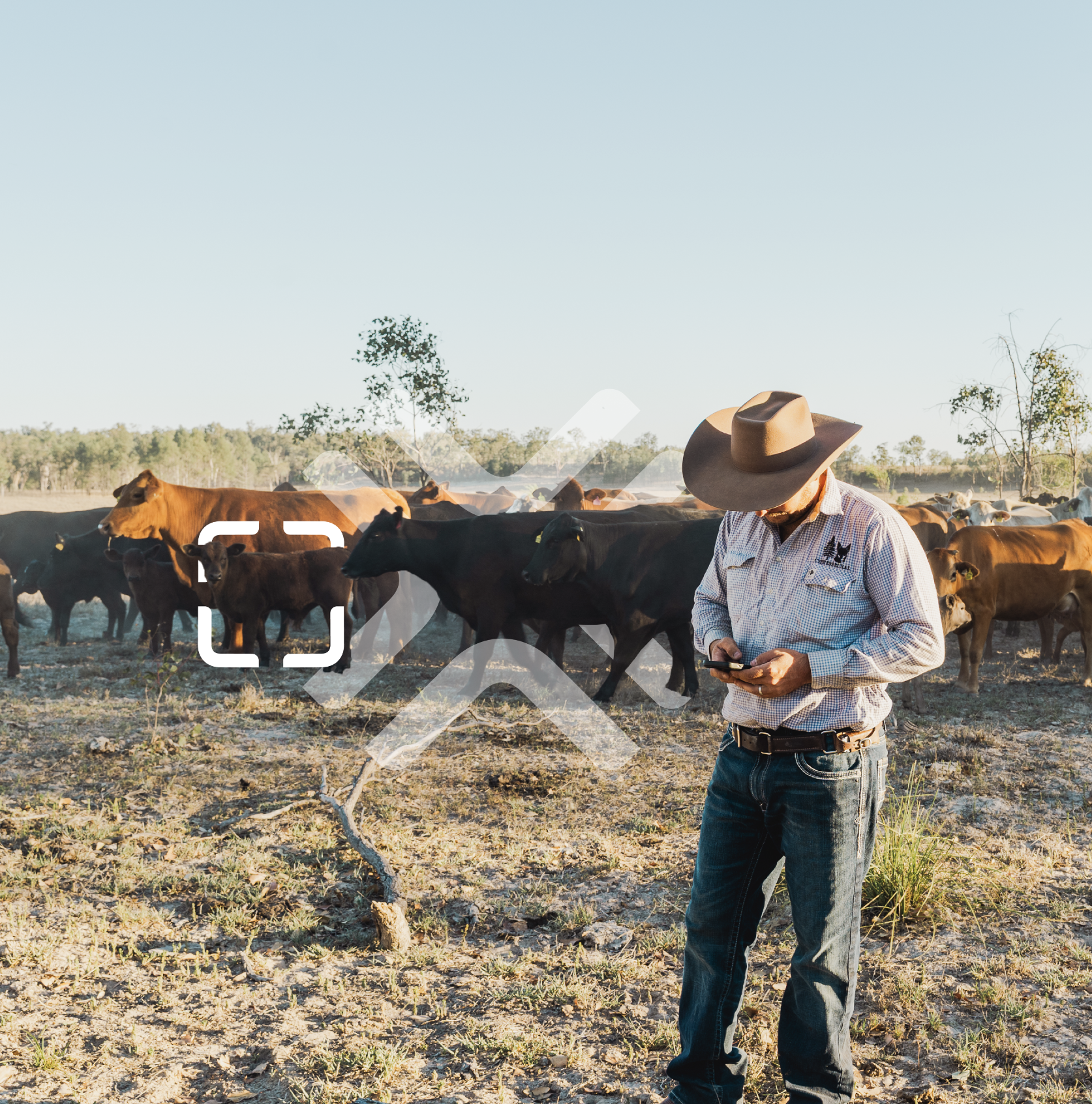
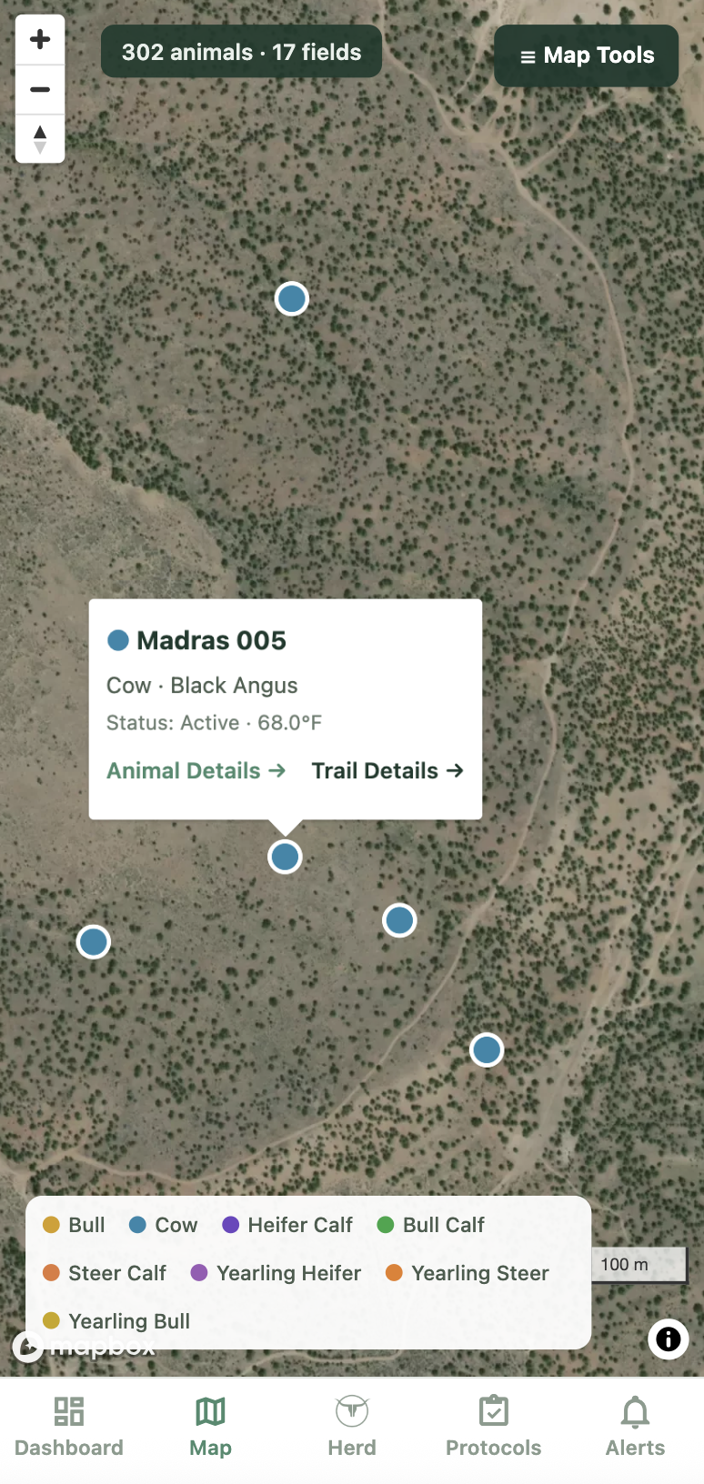
When you have hundreds of acres and dozens of pastures to navigate, it helps to know exactly where your herd is before you saddle up.
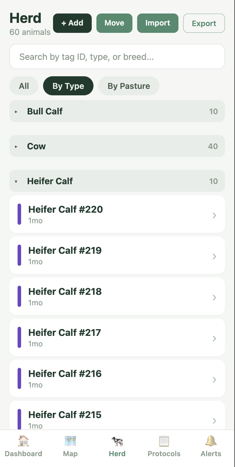
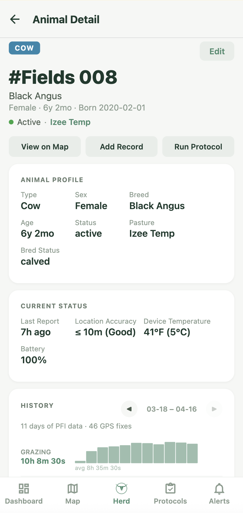
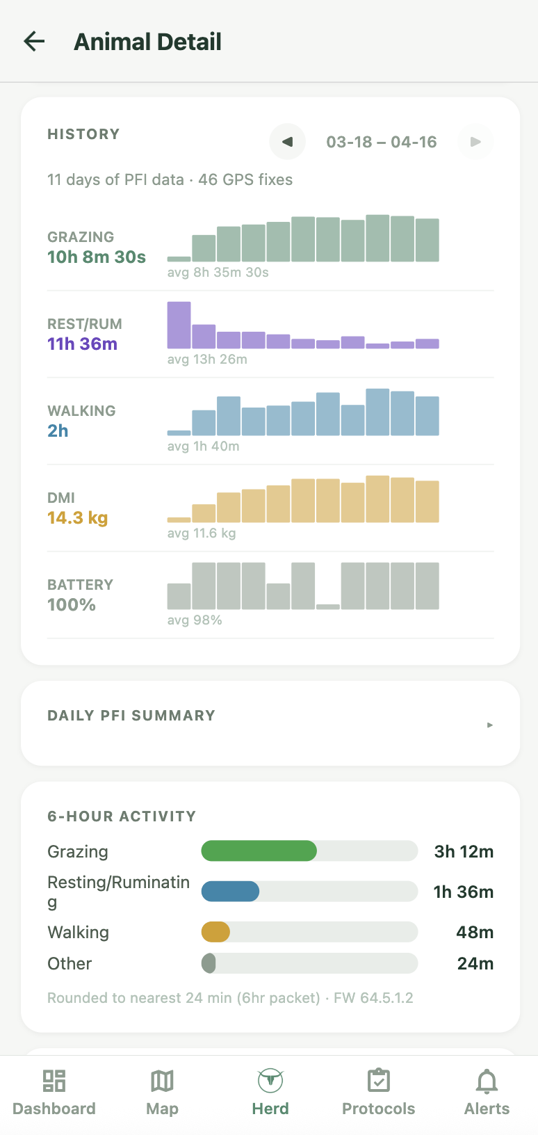
Keep digital records of every treatment and every movement with just a tap of a button.
Finding an issue too late can cost thousands of dollars, geofencing and animal activity updates save time finding problems and improve your ability to deal with them.
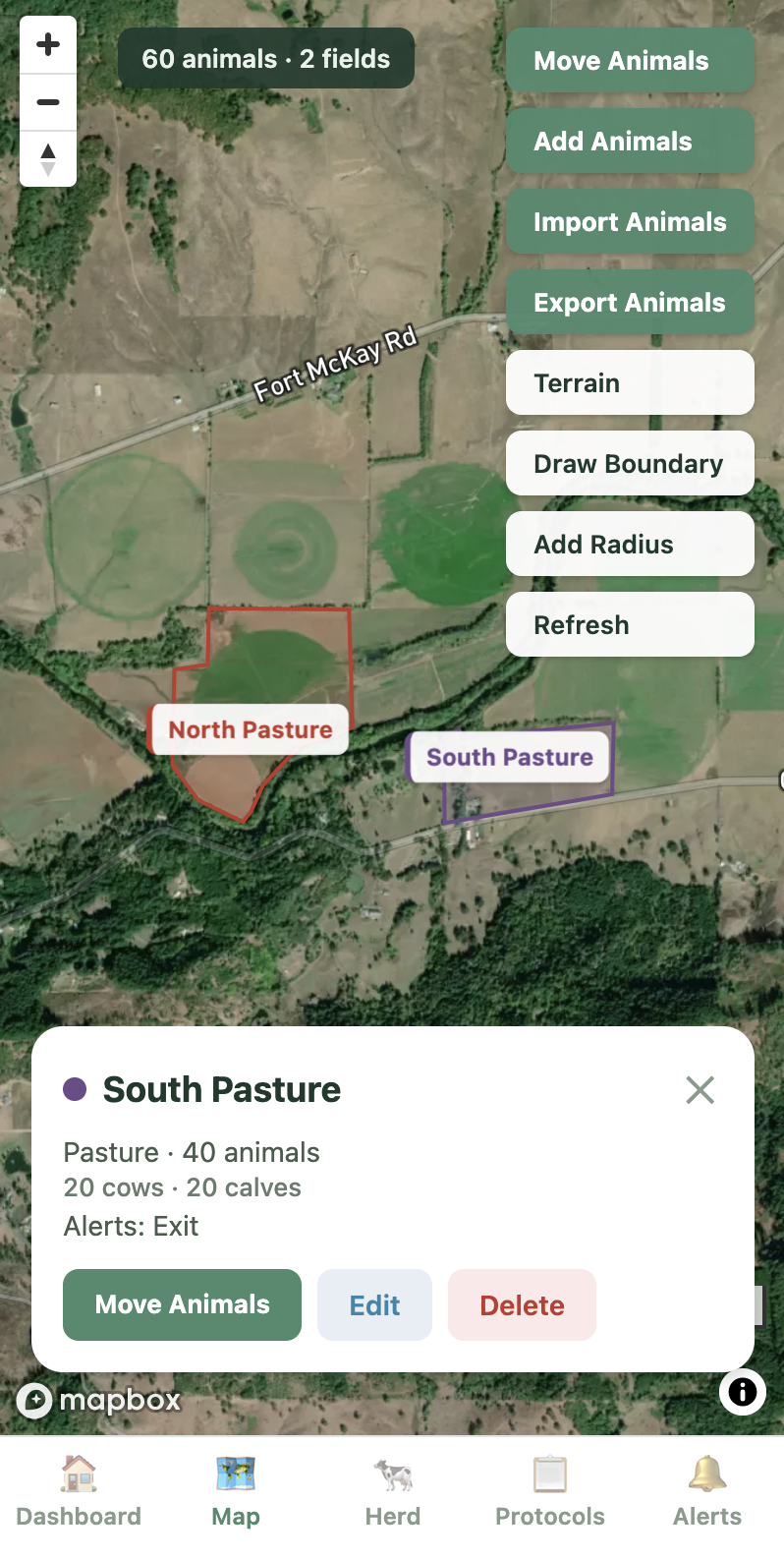
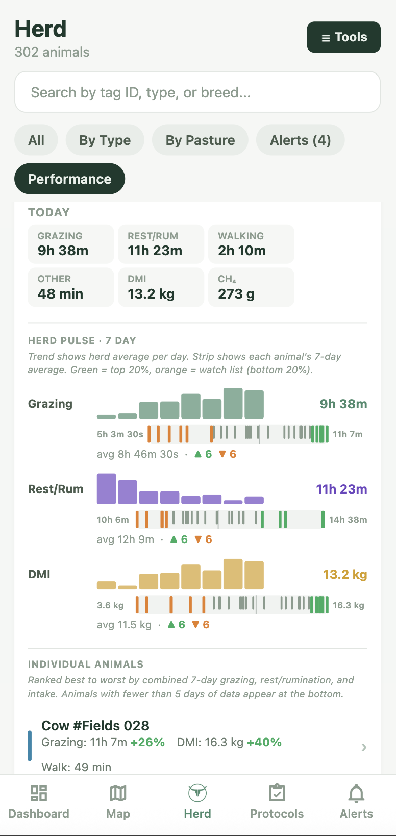
Create your ranch, draw your pasture boundaries on the satellite map, and import your existing herd records. Takes 15 minutes.
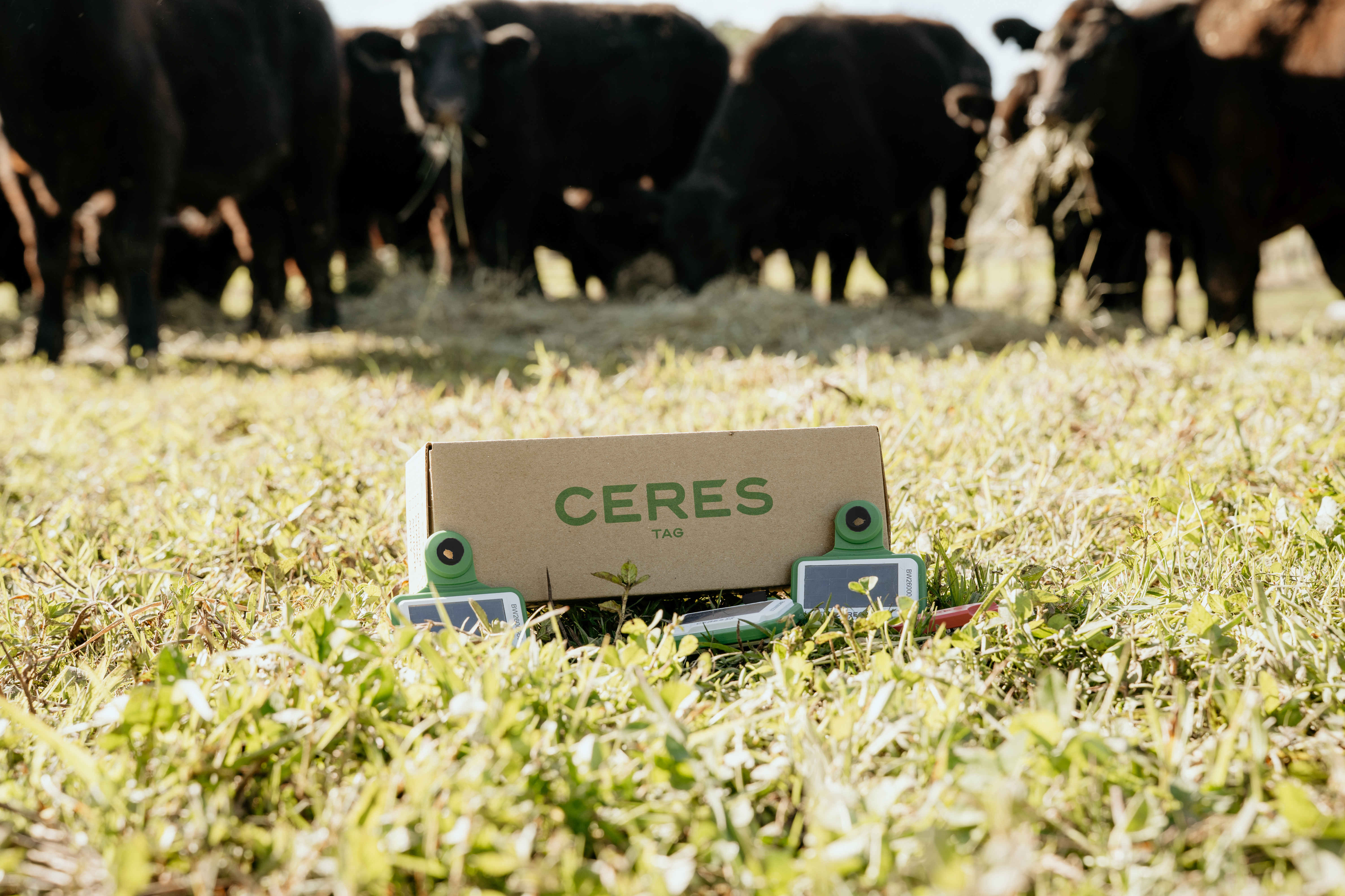
Ceres satellite ear tags report location via satellite. No cell towers, no base stations, no WiFi needed. Works everywhere.
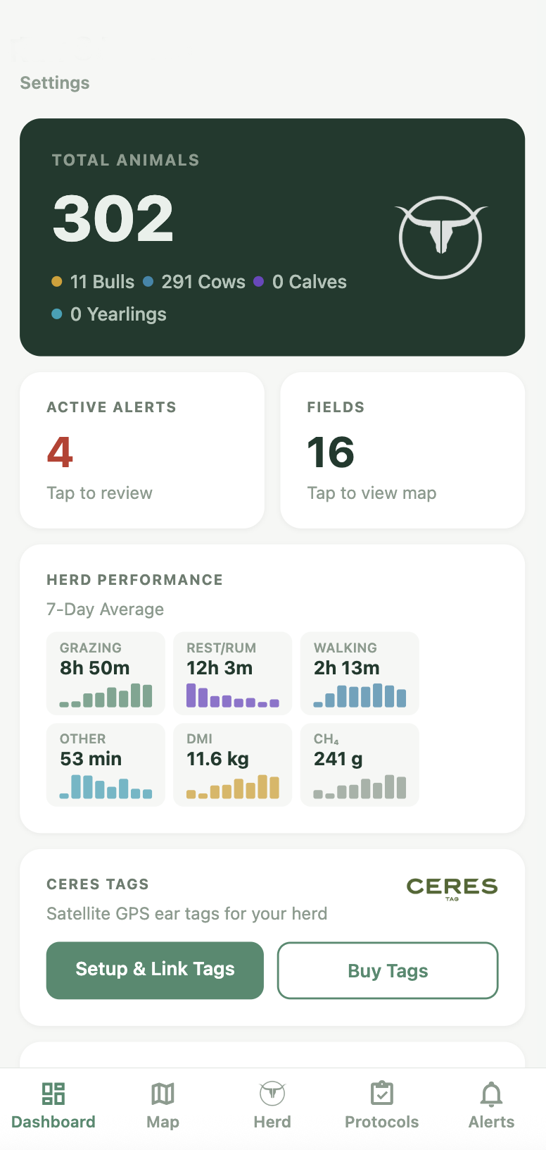
Dashboard, map, protocols, alerts — all from your phone in the field or your desktop in the office. Checking the herd with your morning coffee has never been easier.
Fall Vaccination Protocol
Animal #882
Bred Heifer • Angus
Animal #883
In Chute Now
Processed 45 calves in 90 minutes • 2.0m avg/animal
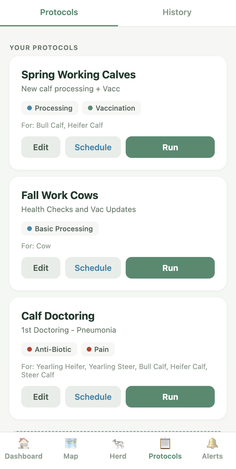
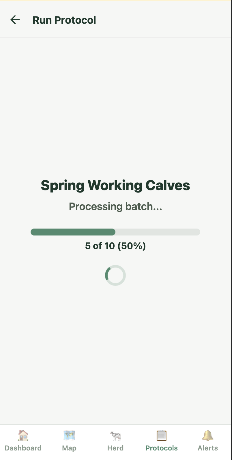
Save time by just documenting data once. With Ranch Protocols, you touch the animal's tag, select the protocol, and you're done. Vaccinations, processing, and treatments are logged and synced across the whole team instantly.
GPS positions on satellite imagery. Color-coded pins for bulls, cows, and calves. 7-day movement trails. Works on BLM allotments and open range.
Push notifications for geofence exits, no-activity alerts, estrus detection, and calving events, all with adjustable priorities.
Touch tag. Select protocol. Done. Auto-filled records for processing, vaccinations, preg checks, and treatments. No spreadsheets.
Owner, managers, ranch hands — everyone sees the same dashboard. Protocols double as training guides for new cowboys.
The app is free up to 100 head. The tags are what track your cattle.
When you put a GPS tag on a cow, you're paying three separate things. No hidden fees, no bundled markup — here's exactly what each one does.
Built by Ceres
A solar-powered GPS ear tag built by Ceres Tag. Satellite connection, not cellular — works anywhere a cow can walk.
Shop Ceres Tags arrow_forwardPaid to Ceres
What keeps your tag talking to the satellite constellation overhead. No cell towers, no base stations, no Wi-Fi. This fee goes directly to Ceres to maintain the connection. Think of it like your cell phone bill.
TerraOptics — that's us
This is what you pay us. We pull your data off the satellite feed, map it to your ranch, keep your records, and ping your phone when something needs attention. Free if you don't need GPS yet.
Adjust your herd size to see how a Satellite GPS system could benefit your bottom line with tags on just 20% of your herd.
| Herd Size | Annual Cost | Est. Value Recovered | Net Gain | ROI |
|---|---|---|---|---|
| 50 head | $1,419 | $2,650 | +$1,231 | 1.9× |
| 100 head | $2,477 | $5,300 | +$2,823 | 2.1× |
| 250 head | $5,653 | $13,250 | +$7,597 | 2.3× |
| 500 head | $10,947 | $26,500 | +$15,553 | 2.4× |
info Estimates based on industry producer reports and rancher feedback. Actual results vary by operation size, region, and management practices. Tag count assumes 20% of herd covered (bulls + select cows). Software cost = Professional at $29.99/mo.
Powered by Ceres Tag
The world's first direct-to-satellite livestock monitoring platform. Developed with CSIRO, deployed across 30+ countries. Solar-powered GPS ear tags with 10+ year lifespan. No cell towers needed.
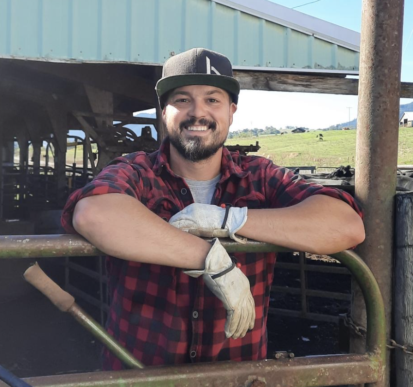
Ron Spencer runs a ranching operation in Umpqua Valley, Oregon and has been building technology to help manage cattle since 2016. He founded TerraOptics because there was nothing available to integrate new technology into operations smoothly and effectively. New technology should make things easier, not more difficult and frustrating. Every system on TerraOptics is tested on our own ranch before ever being pushed through to our customers.
Read our story arrow_forward